Vision Zero: Ending Traffic-Related Injuries and Fatalities
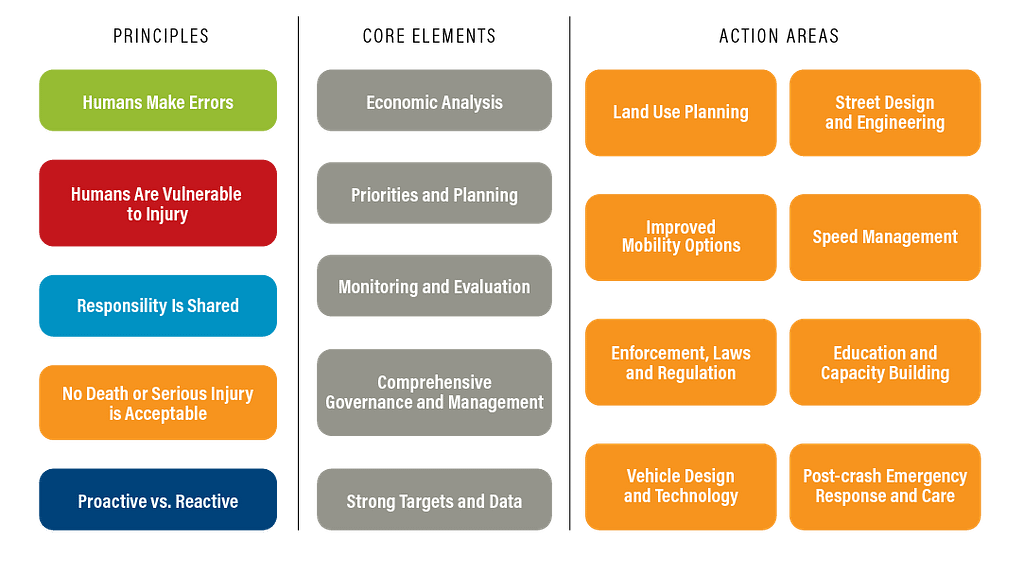
In 1997, Sweden created Vision Zero, a national road policy with the goal of ending all traffic-related injuries and fatalities. At the core of the initiative is the Safe System strategy that reviews street designs, ultimately shifting the onus from street users to the designs themselves. Since then, more than 20 cities across the globe, including Bellevue, Washington (just outside of Seattle) have adopted the Vision Zero action plan.
The City of Bellevue is looking to achieve Vision Zero by 2030. To reach their goal, they’re looking at existing city street designs, how to educate drivers and pedestrians, and leveraging technology partnerships. They identified that 55% of serious injury and fatal related road collisions involve walkers and bicyclists – both of which are classified as vulnerable road users (VRUs). Because of this, they’re focusing on the most densely populated areas of the city that account for 62% of transit usage – the same areas that are preparing for 30,000 new jobs, 27,000 new residents, and five Sound Transit light rail stations in the next few years.
Bellevue is focusing on VRU safety by ramping up off-street pathways, separated bike lanes, pedestrian refuge islands, and real-time conflict analytics monitoring at intersections and light rail crossings.
Safe System Approach
Achieving Vision Zero Through Video Analytics Insights
Making all of this possible is a collaboration across the City of Bellevue, King County, Sound Transit, Amazon Web Services (AWS), Advanced Mobility Analytics Group (AMAG), Miovision, T-Mobile, and Qualcomm.
AMAG provides software technology to analyze, forecast, benchmark, and diagnose transportation system risk. These insights inform strategies to optimize both the infrastructure design and operation of transportation networks for all road users. The innovation behind the solution is the use of computer-vision, machine learning, analysis, and prediction methods backed by years of research to accurately predict conflicts and crashes based on small windows of road-user videos.

